Charter activations
美国飓风马修
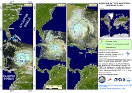
10月6日晚,飓风马修袭击了美国。强大的暴风雨已经造成46人死亡,引发了毁灭性的洪水,对东南部各州的近三百万人造成了影响。
本周早些时候,这场风暴已经发展成为第四类风暴,并袭击了海地和其他加勒比国家,有人担心其到达美国时仍将处于这种强度。目前它已经减弱到第一类,然而,当它到达时,虽然没有正式登陆,但它非常接近东海岸通过。第一类风暴是萨菲尔 - 辛普森飓风量表的最低水平,尽管如此,马修仍带来了从佛罗里达州到马里兰州沿海的暴雨和强风。海岸的一些地区也经历了高达2米(7英尺)的风暴潮。
随着马修的临近,政府动员了应急响应小组以应对这场灾难。佛罗里达州、佐治亚州和南卡罗来纳州宣布进入紧急状态,大约有200万人被迫撤离并向内陆转移。风暴过后,数百万户停电,河流水位上升到危险的水平,导致附近城镇的局部洪水,许多人被困在洪水地区。北卡罗莱纳州遭受到最严重的水灾,这个州的26人已经死亡。
据估计,有10万座建筑在一定程度上受到飓风的破坏,预计受灾州的农业也将受到很大的破坏。
虽然风暴已经过去,洪水正在消退,但一些河流的水位仍然很高,令人担忧的是未来几天还会出现洪水。
| 事件类型: | 海洋风暴 - 飓风 |
| 事件地点: | 美国 |
| 启动宪章的日期: | 2016年10月6日 |
| 宪章启动时间: | 08:55:33 |
| 宪章启动时区: | UTC+02:00 |
| 宪章要求者: | 美国地质调查局(USGS)代表联邦紧急事务管理署 |
| 项目经理: | NC应急管理 |
Products
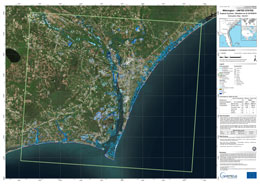
Situation map of Palm Coast, on 9 October 2016
版权: RADARSAT-2 Data and Products © MacDonald, Dettwiler and Associates Ltd. (2016) - All Rights Reserved. RADARSAT is an official trademark of the Canadian Space Agency.
Sentinel-1 © Contains modified Copernicus Sentinel data (2016)
Map produced by GAF AG
Information about the Product
已获得: RADARSAT-2: 07/10/2016
Sentinel-1: 09/10/2016
源: RADARSAT-2 / Sentinel-1
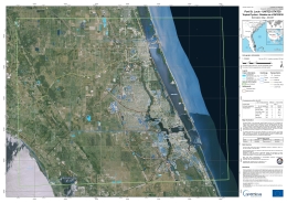
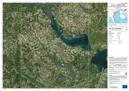
Situation map as of 09 Oct 2016, Port St. Lucie, United States
版权: RADARSAT-2 Data and Products © MacDonald, Dettwiler and Associates Ltd. (2016) - All Rights Reserved. RADARSAT is an official trademark of the Canadian Space Agency.
Map produced by SERTIT
Information about the Product
已获得: 09/10/2016
源: RADARSAT-2
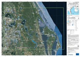
Situation map as of 09 October 2016, Titusville, United States
版权: Sentinel-1 © Contains modified Copernicus Sentinel data (2016)
RADARSAT-2 Data and Products © MacDonald, Dettwiler and Associates Ltd. (2016) - All Rights Reserved. RADARSAT is an official trademark of the Canadian Space Agency.
Map produced by SERTIT
Information about the Product
已获得: Sentinel-1: 09/10/2016
RADARSAT-2: 07/10/2016
源: Sentinel-1 / RADARSAT-2
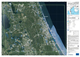
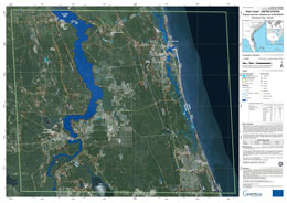
Situation map as of 09 October 2016, Daytona Beach, United States
版权: Sentinel-1 © Contains modified Copernicus Sentinel data (2016)
RADARSAT-2 Data and Products © MacDonald, Dettwiler and Associates Ltd. (2016) - All Rights Reserved. RADARSAT is an official trademark of the Canadian Space Agency.
Map produced by SERTIT
Information about the Product
已获得: Sentinel-1: 09/10/2016
RADARSAT-2: 07/10/2016
源: Sentinel-1 / RADARSAT-2
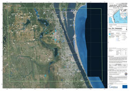
Situation map as of 09 October 2016, Satellite Beach, United States
版权: Sentinel-1 © Contains modified Copernicus Sentinel data (2016)
RADARSAT-2 Data and Products © MacDonald, Dettwiler and Associates Ltd. (2016) - All Rights Reserved. RADARSAT is an official trademark of the Canadian Space Agency.
Map produced by SERTIT
Information about the Product
已获得: Sentinel-1: 09/10/2016
RADARSAT-2: 07/10/2016
源: Sentinel-1 / RADARSAT-2
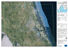
Situation map as of 07 Oct 2016, Port St. Lucie, United States
版权: RADARSAT-2 Data and Products © MacDonald, Dettwiler and Associates Ltd. (2016) - All Rights Reserved. RADARSAT is an official trademark of the Canadian Space Agency.
Map produced by SERTIT
Information about the Product
已获得: 07/10/2016
源: RADARSAT-2
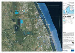
Situation map as of 07 Oct 2016, Sebastian, United States
版权: RADARSAT-2 Data and Products © MacDonald, Dettwiler and Associates Ltd. (2016) - All Rights Reserved. RADARSAT is an official trademark of the Canadian Space Agency.
Map produced by SERTIT
Information about the Product
已获得: 07/10/2016
源: RADARSAT-2
 返回完整的响应档案

 English
 Spanish
 French
 Chinese
 Russian
 Portuguese
