Charter activations
Hurricane Matthew in the United States
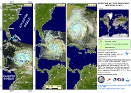
Hurricane Matthew hit the United States on the evening of 6 October. The powerful storm left 46 dead and caused devastating floods that affected almost three million people across the southeastern states.
The storm had been Category Four earlier in the week when it hit Haiti and other Caribbean nations, and there had been concerns that it would be at this intensity when it reached the United States. It had been reduced to Category One, however, when it arrived, and while it did not officially make landfall it passed very close to the eastern coast. A Category One storm is the lowest level on the Saffir-Simpson hurricane scale, but despite this, Matthew brought torrential rain and powerful winds along the coast from Florida to Maryland. Some areas of the coast also experienced storm surges 2 metres (7 feet) in height.
As Matthew approached, the government mobilised emergency response teams in anticipation of the disaster. A state of emergency was declared in Florida, Georgia and South Carolina where approximately two million people were urged to evacuate and move inland. In the wake of the storm, millions were left without power, rivers levels had risen to dangerous levels causing localised flooding of nearby towns and many people were left stranded in flooded areas. North Carolina suffered the worst of the flooding, and 26 people died in this state.
Estimates suggest 100,000 buildings were damaged to some degree by the hurricane and it is expected that agriculture in the affected states will also suffer greatly.
Though the storm has passed now, and floodwaters are receding, water levels in some rivers are still dangerously high, leaving concerns about further flooding to come.
| Tipo de evento: | Ocean Storm - Hurricane |
| Local do evento: | United States of America |
| Data da Ativação da Carta: | 6 October 2016 |
| Tempo de Ativação da Carta: | 08:55:33 |
| Zona de Tempo da Ativação da Carta: | UTC+02:00 |
| Requisitante da Carta: | USGS on behalf of Federal Emergency Management Agency |
| Gerenciamento de projeto: | NC Emergency Management |
Products
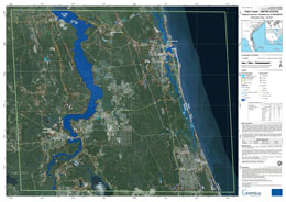
Situation map of Palm Coast, on 9 October 2016
Direitos autorais: RADARSAT-2 Data and Products © MacDonald, Dettwiler and Associates Ltd. (2016) - All Rights Reserved. RADARSAT is an official trademark of the Canadian Space Agency.
Sentinel-1 © Contains modified Copernicus Sentinel data (2016)
Map produced by GAF AG
Information about the Product
Adquirida: RADARSAT-2: 07/10/2016
Sentinel-1: 09/10/2016
Fonte: RADARSAT-2 / Sentinel-1
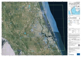
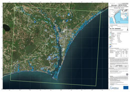
Situation map as of 09 Oct 2016, Port St. Lucie, United States
Direitos autorais: RADARSAT-2 Data and Products © MacDonald, Dettwiler and Associates Ltd. (2016) - All Rights Reserved. RADARSAT is an official trademark of the Canadian Space Agency.
Map produced by SERTIT
Information about the Product
Adquirida: 09/10/2016
Fonte: RADARSAT-2
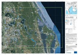
Situation map as of 09 October 2016, Titusville, United States
Direitos autorais: Sentinel-1 © Contains modified Copernicus Sentinel data (2016)
RADARSAT-2 Data and Products © MacDonald, Dettwiler and Associates Ltd. (2016) - All Rights Reserved. RADARSAT is an official trademark of the Canadian Space Agency.
Map produced by SERTIT
Information about the Product
Adquirida: Sentinel-1: 09/10/2016
RADARSAT-2: 07/10/2016
Fonte: Sentinel-1 / RADARSAT-2
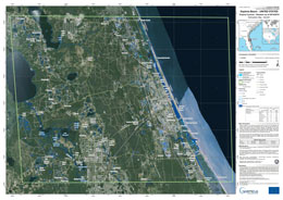
Situation map as of 09 October 2016, Daytona Beach, United States
Direitos autorais: Sentinel-1 © Contains modified Copernicus Sentinel data (2016)
RADARSAT-2 Data and Products © MacDonald, Dettwiler and Associates Ltd. (2016) - All Rights Reserved. RADARSAT is an official trademark of the Canadian Space Agency.
Map produced by SERTIT
Information about the Product
Adquirida: Sentinel-1: 09/10/2016
RADARSAT-2: 07/10/2016
Fonte: Sentinel-1 / RADARSAT-2
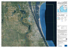
Situation map as of 09 October 2016, Satellite Beach, United States
Direitos autorais: Sentinel-1 © Contains modified Copernicus Sentinel data (2016)
RADARSAT-2 Data and Products © MacDonald, Dettwiler and Associates Ltd. (2016) - All Rights Reserved. RADARSAT is an official trademark of the Canadian Space Agency.
Map produced by SERTIT
Information about the Product
Adquirida: Sentinel-1: 09/10/2016
RADARSAT-2: 07/10/2016
Fonte: Sentinel-1 / RADARSAT-2
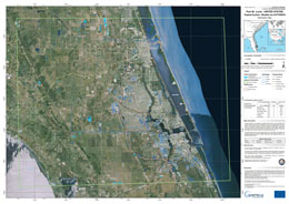
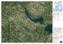
Situation map as of 07 Oct 2016, Port St. Lucie, United States
Direitos autorais: RADARSAT-2 Data and Products © MacDonald, Dettwiler and Associates Ltd. (2016) - All Rights Reserved. RADARSAT is an official trademark of the Canadian Space Agency.
Map produced by SERTIT
Information about the Product
Adquirida: 07/10/2016
Fonte: RADARSAT-2
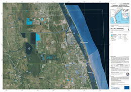
Situation map as of 07 Oct 2016, Sebastian, United States
Direitos autorais: RADARSAT-2 Data and Products © MacDonald, Dettwiler and Associates Ltd. (2016) - All Rights Reserved. RADARSAT is an official trademark of the Canadian Space Agency.
Map produced by SERTIT
Information about the Product
Adquirida: 07/10/2016
Fonte: RADARSAT-2
 Voltar ao arquivo completo da Ativação

 English
 Spanish
 French
 Chinese
 Russian
 Portuguese
