Свернуть Последняя Активация

Charter activations

Earthquake and landslide in Costa Rica

A 6.1-magnitude earthquake shook north-central Costa Rica on 8 January and many rural towns have been under serious landslide threat. At least 220 people were injured during the earthquake and 34 people died. Electrical infrastructure and roads were also seriously damaged.

Тип события:Earthquake and landslide
Место события:Costa Rica
Date of Charter Activation:08/01/2009
Запрос на активацию поступил от:SIFEM (Sistema Federal de Emergencias)
Менеждер проекта от:CONAE

Products

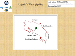
Map of Alajuela's Water pipeline of 08/01/2009 - affected area

Авторские права: CONAE 2009
Image processing, map created 08/01/2009 by ICE.

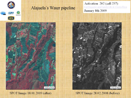
Earthquake and landslide in Costa Rica

Авторские права: CONAE 2009
Image processing, map created 08/01/2009 by ICE.

Information about the Product

Получено: 18/01/2009 and 28/02/2008

Источник: SPOT

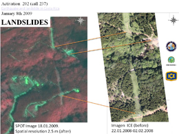
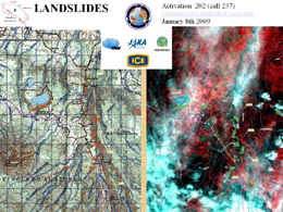
Landslides

Авторские права: CONAE 2009. Image processing, map created 08/01/2009 by ICE.

Information about the Product

Получено: 18/01/2009 and 22/01/2008 - 02/02/2008

Источник: SPOT 2.5 m resolution (post event) and ICE (before event)

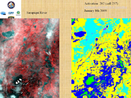
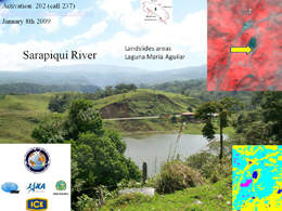
Sarapiquí River

Авторские права: CONAE 2009. Image processing, map created 08/01/2009 by ICE.

Sarapiquí River

Авторские права: CONAE 2009 Image processing, map created 08/01/2009 by ICE.

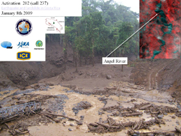
Angel River

Авторские права: CONAE 2009
Image processing, map created 08/01/2009 by ICE.

Landslides

Авторские права: CONAE 2009 Image processing, map created 08/01/2009 by ICE.

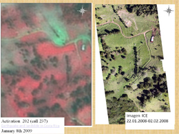
Earthquake and landslide in Costa Rica

Авторские права: CONAE 2009. Image processing, map created 08/01/2009 by ICE.

Information about the Product

Получено: 22/01/2009 - 02/02/2008

Источник: ICE

Вернуться к полному архиву активаций