Minimizar Latest Activation

Charter activations

Earthquake and landslide in Costa Rica

A 6.1-magnitude earthquake shook north-central Costa Rica on 8 January and many rural towns have been under serious landslide threat. At least 220 people were injured during the earthquake and 34 people died. Electrical infrastructure and roads were also seriously damaged.

Tipo de evento:Earthquake and landslide
Local do evento:Costa Rica
Data da Ativação da Carta:08/01/2009
Requisitante da Carta:SIFEM (Sistema Federal de Emergencias)
Gerenciamento de projeto:CONAE

Products

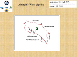
Map of Alajuela's Water pipeline of 08/01/2009 - affected area

Direitos autorais: CONAE 2009
Image processing, map created 08/01/2009 by ICE.

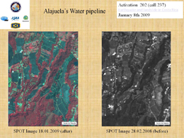
Earthquake and landslide in Costa Rica

Direitos autorais: CONAE 2009
Image processing, map created 08/01/2009 by ICE.

Information about the Product

Adquirida: 18/01/2009 and 28/02/2008

Fonte: SPOT

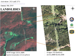
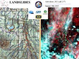
Landslides

Direitos autorais: CONAE 2009. Image processing, map created 08/01/2009 by ICE.

Information about the Product

Adquirida: 18/01/2009 and 22/01/2008 - 02/02/2008

Fonte: SPOT 2.5 m resolution (post event) and ICE (before event)

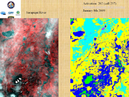
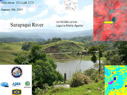
Sarapiquí River

Direitos autorais: CONAE 2009. Image processing, map created 08/01/2009 by ICE.

Sarapiquí River

Direitos autorais: CONAE 2009 Image processing, map created 08/01/2009 by ICE.

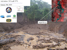
Angel River

Direitos autorais: CONAE 2009
Image processing, map created 08/01/2009 by ICE.

Landslides

Direitos autorais: CONAE 2009 Image processing, map created 08/01/2009 by ICE.

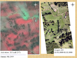
Earthquake and landslide in Costa Rica

Direitos autorais: CONAE 2009. Image processing, map created 08/01/2009 by ICE.

Information about the Product

Adquirida: 22/01/2009 - 02/02/2008

Fonte: ICE

Voltar ao arquivo completo da Ativação