Charter activations
Tropical Storm Trami in the Philippines
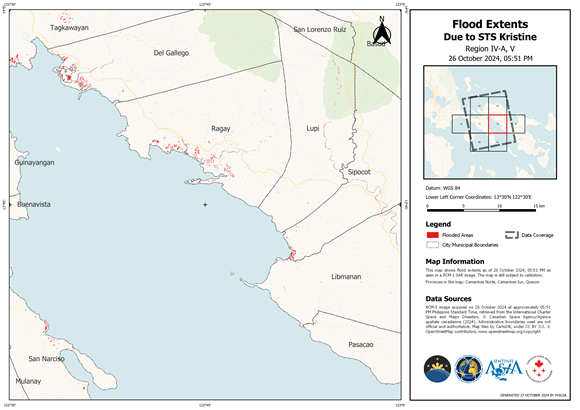
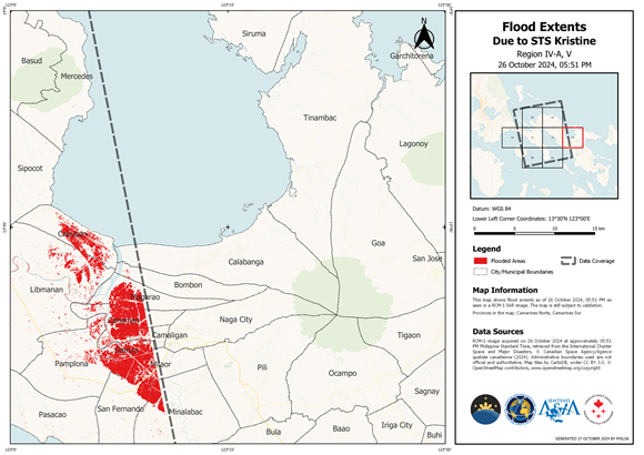
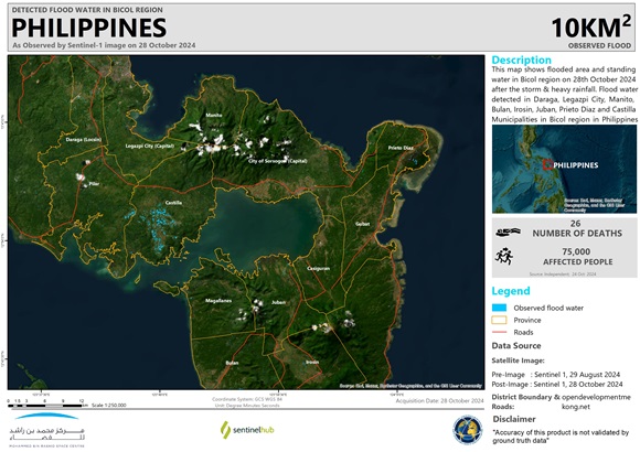
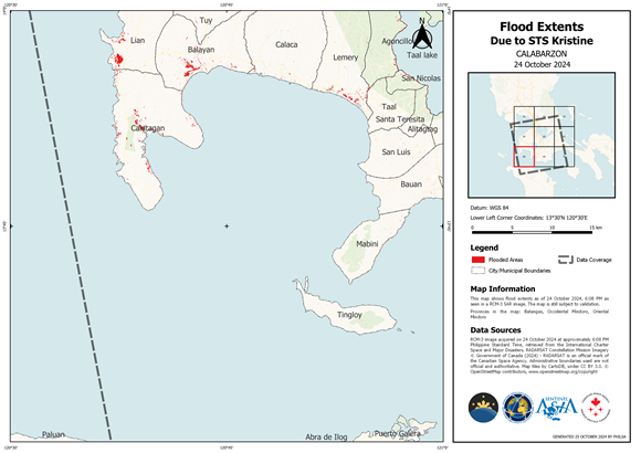
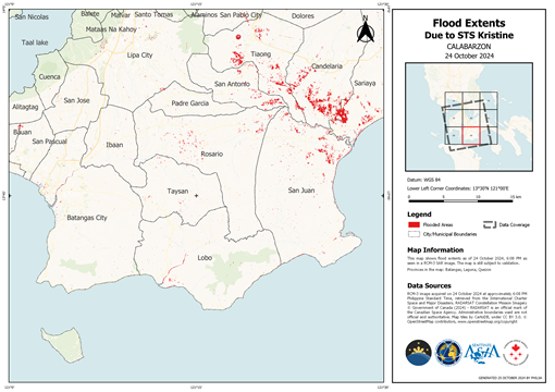
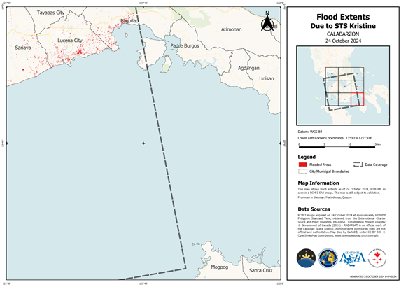
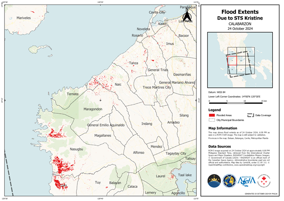
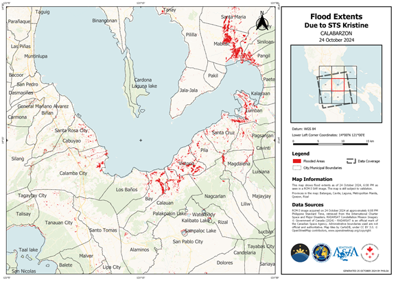
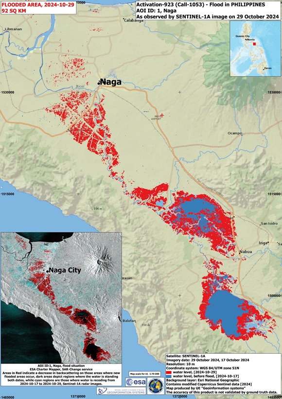
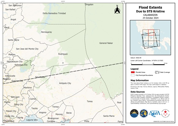
Torrential rains brought by tropical storm Trami, locally called storm Kristine, triggered widespread flooding in eastern Philippines that has killed at least nine people, turned streets into rivers, submerged entire villages and buried some vehicles in volcanic sediment set loose by the downpour.
Thousands more people were marooned in their homes and on rooftops as emergency services have struggled to respond to a deluge of rescue requests.
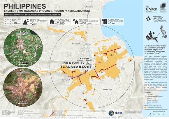
Landslides are also expected in many areas with heavy rainfall warnings, prompting the Philippine Atmospheric, Geophysical and Astronomical Services Administration (PAGASA) to advise the public and disaster offices to take all necessary measures to protect life and property.
Typhoons are common around the region at this time of year; however, a recent study showed that they are increasingly forming closer to coastlines, intensifying more rapidly and lasting longer over land due to climate change.
About 20 big storms and typhoons hit the Philippines or its surrounding waters each year, Trami is the 11th storm to hit so far in 2024.
| 事件类型: | Flood |
| 事件地点: | Philippines |
| 启动宪章的日期: | 2024-10-23 |
| 宪章启动时间: | 12:10 |
| 宪章启动时区: | UTC+09:00 |
| 宪章要求者: | ADRC on behalf of PAGASA |
| 启动ID: | 923 |
| 项目经理: | Julius Judan (PhilSA-SMCOD (Space Mission Control and Operations Division)) |
| act-value-adders: | PhilSA Philippine Atmospheric Geophysical and Astronomical Services Administration (PAGASA) Abigail C. Pidlaoan (DOST-Philippine Institute of Volcanology and Seismology) Jakrapong Tawala (UNITAR) Mohammed Bin Rashid Space Centre |
Products
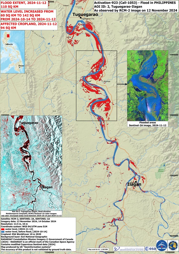
Flood situation in Tuguegarao-Ilagan The Philippines,
版权: Contains modified Copernicus Sentinel data (2024)
RADARSAT Constellation Mission Imagery © Government of Canada (2024) - RADARSAT is an official mark of the Canadian Space Agency
Map produced by UE Geoinformation Systems
Information about the Product
已获得: Sentinel-1: 14/10/2024, Sentinel-2: 12/11/2024, RCM-2: 12/11/2024
源: Sentinel-1, Sentinel-2, RCM
类别: Reference Map
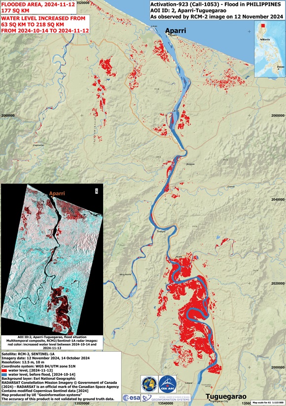
Flood situation in Aparri-Tuguegarao, The Philippines
版权: Contains modified Copernicus Sentinel data (2024)
RADARSAT Constellation Mission Imagery © Government of Canada (2024) - RADARSAT is an official mark of the Canadian Space Agency
Map produced by UE "Geoinformation systems"
Information about the Product
已获得: Sentinel-1: 14/10/2024
RCM: 12/11/2024
源: RCM, Sentinel-1
类别: Reference Map
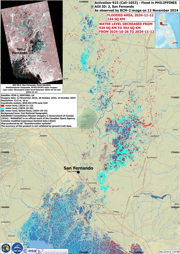
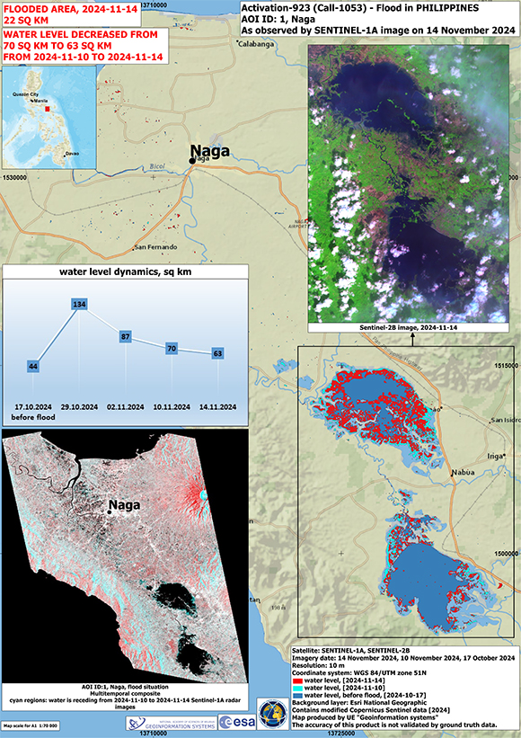
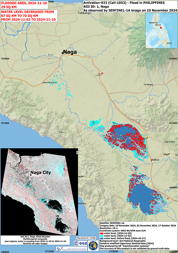
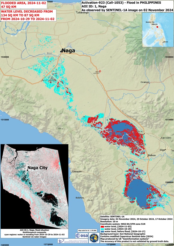
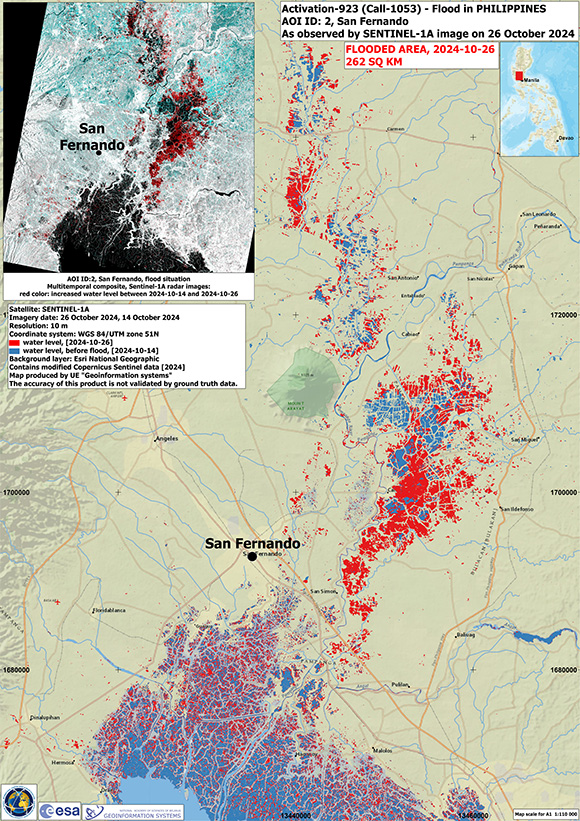
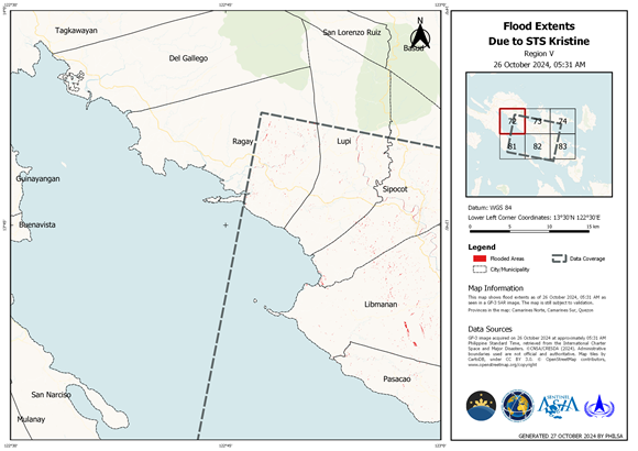
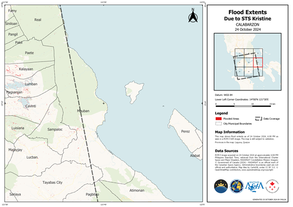
Flood situation in San Fernando, The Philippines
版权: Contains modified Copernicus Sentinel data (2024)
RADARSAT Constellation Mission Imagery © Government of Canada (2024) - RADARSAT is an official mark of the Canadian Space Agency
Map produced by UE "Geo-Information Systems"
Information about the Product
已获得: Sentinel-1: 14/10/2024, 26/10/2024
RCM: 24/10/2024, 12/11/2024
源: Sentinel-1, RCM
类别: Delineation Monitoring Maps
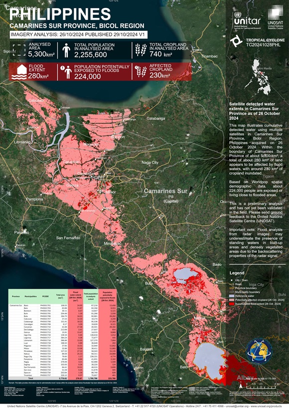
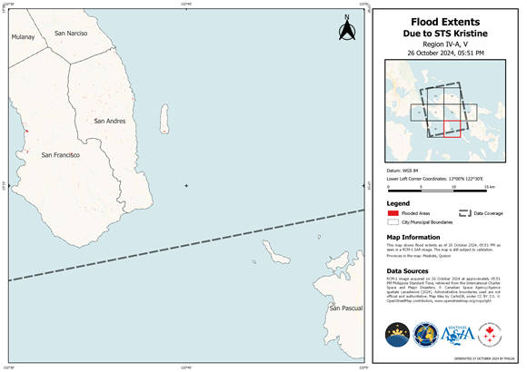
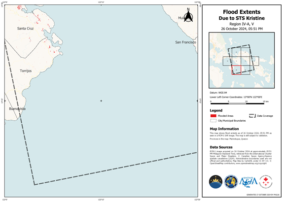
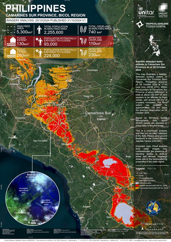
Areas affected by flooding in Camarines Sur Province
版权: RADARSAT Constellation Mission Imagery © Government of Canada (2024) - RADARSAT is an official mark of the Canadian Space Agency
Contains modified Copernicus Sentinel data (2024)
©CNSA/CRESDA (2024)
Map produced by UNITAR / UNOSAT
Information about the Product
已获得: RCM: 25/10/2024
Sentinel-2: 25/10/2024
GF3: 25/10/2024
源: RCM, Sentinel-2, GF3
类别: Reference Map
 返回完整的响应档案

 English
 Spanish
 French
 Chinese
 Russian
 Portuguese
