Charter activations
Flood in Mexico
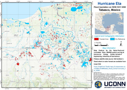
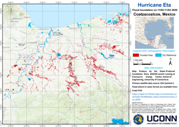
Topical storm Eta brought heavy rainfall across south and south east Mexico affecting over 100,000 people. At least 21 people have been killed and thousands of homes destroyed.
The worst affected areas of Tabasco, Chiapas and Veracruz, received torrential rain trigggering landslides which claimed 2000 homes. Further landslides have been reported in the municipalities of Yajalón, Tila and Chilón.
At least 10 rivers have burst their banks in the Gulf coast state, causing widespread flooding. The army, navy and Civil Protection services are helping people evacuate their homes.
The National Meteorological Service has forecast more torrential rain in Tabasco, Chiapas and Quintana Roo in the coming days.
News and resources:
| Тип события: | Floods |
| Место события: | Mexico |
| Date of Charter Activation: | 2020-11-06 |
| Время активации Хартии: | 17:36 |
| TЧасовой пояс в районе активации Хартии: | UTC+01:00 |
| Запрос на активацию поступил от: | UNOOSA/UN-SPIDER on behalf of Mexico National Civil Protection System and Mexican Space Agency |
| Номер активации: | 683 |
| Менеждер проекта от: | Autonomous University of Mexico State (UAEMEX) |
Products
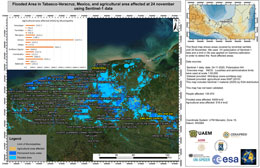
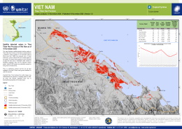
Flooded area in Tabasco-Veracruz, Mexico, and agricultural area affected
Авторские права: Contains modified Copernicus Sentinel data (2020)
Map produced by Autonomous University of Mexico State (UAEMEX), Federal University of Santa María, Brasil; and National Center of Disaster prevention (CENAPRED)
Information about the Product
Получено: 21/11/2020
Источник: Sentinel-1
Flooded Area in Macuspana region Tabasco-Mexico using Pleiades data
Авторские права: Includes Pleiades material © CNES (2020), Distribution Airbus DS.
Map produced by Autonomous University of Mexico State (UAEMEX),
Federal University of Santa María, Brasil; and National Center of Disaster prevention (CENAPRED).
Information about the Product
Получено: 09/11/2020
Источник: Pleiades
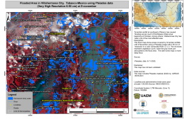
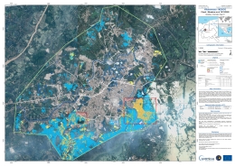
Flooded area in Villahermosa Tabasco-Mexico using Pleiades data
Авторские права: Includes Pleiades material © CNES (2020), Distribution Airbus DS.
Map produced by Autonomous University of Mexico State (UAEMEX),
Federal University of Santa María, Brasil; and National Center of Disaster prevention (CENAPRED).
Information about the Product
Получено: 08/11/2020
Источник: Pleiades
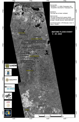
Area cover by floodings in Tabasco-Mexico using TerraSAR-X and TanDEM-X data
Авторские права: © DLR e.V. (2013), Distribution Airbus DS Geo GmbH
Map produced by Autonomous University of Mexico State (UAEMEX),
Federal University of Santa María, Brasil; and National Center of Disaster prevention (CENAPRED).
Information about the Product
Получено: TerraSAR-X: 07/09/2013
TanDEM-X: 08/11/2020
Источник: TerraSAR-X / TanDEM-X
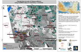
Flooded Area at south of Tabasco-Mexico using TanDEM-X data (1m resolution), 7 November
Авторские права: © DLR e.V. (2020), Distribution Airbus DS Geo GmbH
Map produced by Autonomous University of Mexico State (UAEMEX),
Federal University of Santa María, Brasil; and National Center of Disaster prevention (CENAPRED).
Information about the Product
Получено: 08/11/2020
Источник: TanDEM-X
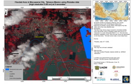
Flooded area in Macuspana City, Tabasco-Mexico using Pleiades data (High resolution 0.5 cm) at 8 November
Авторские права: Includes Pleiades material © CNES (2020), Distribution Airbus DS.
Map produced by Autonomous University of Mexico State (UAEMEX),
Federal University of Santa María, Brasil; and National Center of Disaster prevention (CENAPRED).
Information about the Product
Получено: 08/11/2020
Источник: Pleiades
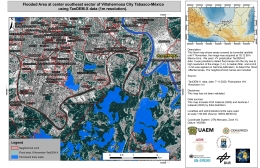
Flooded Area at center southeast sector of Villahermosa City Tabasco, México using TanDEM-X data (1m resolution) at 7 November
Авторские права: © DLR e.V. (2020), Distribution Airbus DS Geo GmbH
Map produced by Autonomous University of Mexico State (UAEMEX), Federal University of Santa María, Brasil; and National Center of Disaster prevention (CENAPRED)
Information about the Product
Получено: 08/11/2020
Источник: TanDEM-X
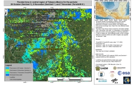
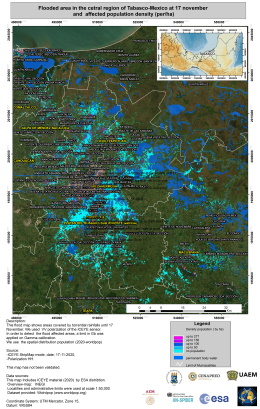
Flooded Area in central region of Tabasco, Mexico
Авторские права: Contains modified Copernicus Sentinel data (2020)
© DLR e.V. (2020), Distribution Airbus DS Geo GmbH
Map produced by Autonomous University of Mexico State (UAEMEX), Federal University of Santa María, Brasil; and National Center of Disaster prevention (CENAPRED)
Information about the Product
Получено: Sentinel-1: 28/10/2020 and 05/11/2020
TerraSAR-X: 07/11/2020
Источник: Sentinel-1 and TerraSAR-X
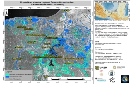
Flooded Area at central region of Tabasco, Mexico
Авторские права: © DLR e.V. (2020), Distribution Airbus DS Geo GmbH
Map produced by Autonomous University of Mexico State (UAEMEX), Federal University of Santa María, Brasil; and National Center of Disaster prevention (CENAPRED)
Information about the Product
Получено: 07/11/2020
Источник: TerraSAR-X
 Вернуться к полному архиву активаций

 English
 Spanish
 French
 Chinese
 Russian
 Portuguese
