Charter activations
Flooding in Niger
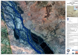
Heavy flooding over the last few weeks has left 65 dead and over 100,000 homeless in Niger, caused by a severe rain season and the River Niger bursting its banks.
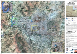
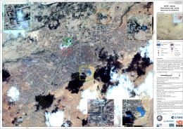
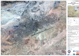
The capital city of Niamey was struck by the flood waters from the River Niger, and Agadez City in the centre of Niger has also been affected.
The Dosso region has suffered the worst effects of the floods, however, with an estimated ten thousand homes destroyed.
Relief and international aid is being provided to help with the recovery.
-
Please see here for the SERTIT rapid mapping webpage for this activation.
| Tipo de evento: | Floods |
| Local do evento: | Niger - Niamey, Dosso, Agadez |
| Data da Ativação da Carta: | 28 August 2012 |
| Requisitante da Carta: | Direction Générale de la Sécurité Civile et de la Gestion des Crises (COGIC) |
| Gerenciamento de projeto: | CNES |
Products
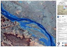
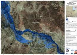
Flood extent map of Niamey and Niger River, Niger
Scale: 1:20000
Direitos autorais: KARI 2012
German Aerospace Center (DLR) 2012, Astrium Services / Infoterra GmbH 2012 TerraSAR-X images were used
Map produced by SERTIT
Information about the Product
Adquirida: KOMPSAT-2: 01/09/2012
TerraSAR-X: 12/08/2012
Fonte: KOMPSAT-2
TerraSAR-X
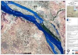
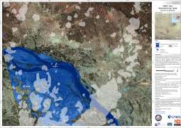
Flood extent map of Kollo and Niger River, Niger
Scale: 1:25000
Direitos autorais: RADARSAT-2 Data and Products © MacDonald, Dettwiler and Associates Ltd. (2012) - All Rights Reserved. RADARSAT is an official trademark of the Canadian Space Agency.
USGS 2011
Map produced by SERTIT
Information about the Product
Adquirida: RADARSAT-2: 01/09/2012
Landsat 5: 25/01/2011
Fonte: RADARSAT-2
Landsat 5
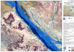
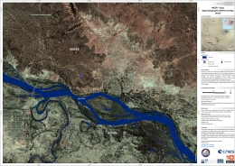
Flood dynamic map - Downstream of Niamey, Niger
Niger River
Scale: 1:25000
Direitos autorais: RADARSAT-2 Data and Products © MacDonald, Dettwiler and Associates Ltd. (2012) - All Rights Reserved. RADARSAT is an official trademark of the Canadian Space Agency.
German Aerospace Center (DLR) 2012, Astrium Services / Infoterra GmbH 2012 TerraSAR-X images were used
KARI 2009
Map produced by SERTIT
Information about the Product
Adquirida: RADARSAT-2: 01/09/2012
TerraSAR-X: 29/08/2012 and 12/08/2012
KOMPSAT-2: 18/04/2009
Fonte: RADARSAT-2
TerraSAR-X
KOMPSAT-2
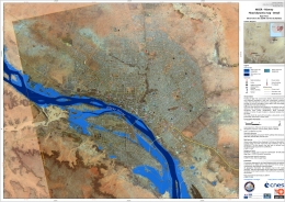
Flood dynamic map of Niamey and Niger River, Niger
Scale: 1:25000
Direitos autorais: RADARSAT-2 Data and Products © MacDonald, Dettwiler and Associates Ltd. (2012) - All Rights Reserved. RADARSAT is an official trademark of the Canadian Space Agency.
German Aerospace Center (DLR) 2012, Astrium Services / Infoterra GmbH 2012 TerraSAR-X images were used
KARI 2009
Map produced by SERTIT
Information about the Product
Adquirida: RADARSAT-2: 01/09/2012
TerraSAR-X: 29/08/2012 and 12/08/2012
KOMPSAT-2: 18/04/2009
Fonte: RADARSAT-2
TerraSAR-X
KOMPSAT-2
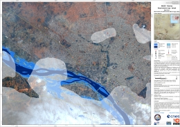
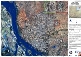
Flood extent map of Niamey, Niger
Scale: 1:20000
Direitos autorais: German Aerospace Center (DLR) 2012, Astrium Services / Infoterra GmbH 2012 TerraSAR-X images were used
KARI 2012
Map produced by SERTIT
Information about the Product
Adquirida: TerraSAR-X: 29/08/2012 and 12/08/2012
KOMPSAT-2: 30/08/2012
Fonte: TerraSAR-X
KOMPSAT-2
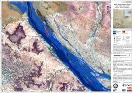
Flood impact map - Downstream of Niamey, Niger
Scale: 1:25000
Direitos autorais: German Aerospace Center (DLR) 2012, Astrium Services / Infoterra GmbH 2012 TerraSAR-X images were used
KARI 2009
Map produced by SERTIT
Information about the Product
Adquirida: TerraSAR-X: 12/08/2010 and 29/08/2012
KOMPSAT-2: 18/04/2009
Fonte: TerraSAR-X
KOMPSAT-2
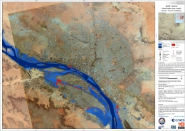
Flood impact map of Niamey, Niger
Scale: 1:25000
Direitos autorais: German Aerospace Center (DLR) 2012, Astrium Services / Infoterra GmbH 2012 TerraSAR-X images were used
KARI 2009
Map produced by SERTIT
Information about the Product
Adquirida: TerraSAR-X: 12/08/2010 and 29/08/2012
KOMPSAT-2: 18/04/2009
Fonte: TerraSAR-X
KOMPSAT-2
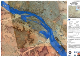
Flood extent map of Niamey, Niger
Scale: 1:25000
Direitos autorais: German Aerospace Center (DLR) 2012, Astrium Services / Infoterra GmbH 2012 TerraSAR-X images were used
KARI 2009
Map produced by SERTIT
Information about the Product
Adquirida: TerraSAR-X: 29/08/2012
KOMPSAT-2: 18/04/2009
Fonte: TerraSAR-X
KOMPSAT-2
 Voltar ao arquivo completo da Ativação

 English
 Spanish
 French
 Chinese
 Russian
 Portuguese
