Charter activations
Flooding in Scotland
Torrential rain hit much of the East of Scotland, with roads and rail travel impacted, schools closed and power cuts affecting areas in Aberdeenshire.
The Rivers Dee, Don, Esk and Tay experienced very high flood water levels.
| Tipo de evento: | Floods |
| Local do evento: | United Kingdom |
| Data da Ativação da Carta: | 2022-11-18 |
| Tempo de Ativação da Carta: | 11:55 |
| Zona de Tempo da Ativação da Carta: | UTC+00:00 |
| Requisitante da Carta: | Civil Contingencies Secretariat (CCS) on behalf of Scottish Environment Protection Agency |
| ID da Ativação: | 790 |
| Gerenciamento de projeto: | Claire Neil (Scottish Environment Protection Agency) |
| act-value-adders: | Dr Cristian Silva Perez Silva Perez (University of Stirling) |
Products

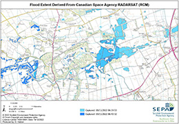
Flood extent derived from Canadian Space Agency RADARSAT RCM
Direitos autorais: RADARSAT Constellation Mission Imagery © Government of Canada (2022) - RADARSAT is an official mark of the Canadian Space Agency
Map produced by Scottish Environment Protection Agency
Information about the Product
Adquirida: 20/11/2022
Fonte: RCM
Categoria: Delineation Monitoring Maps

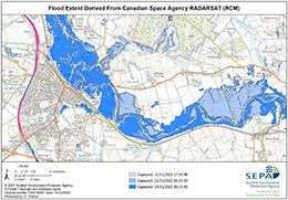
Flood extent derived from Canadian Space Agency RADARSAT RCM
Direitos autorais: RADARSAT Constellation Mission Imagery © Government of Canada (2022) - RADARSAT is an official mark of the Canadian Space Agency
Map produced by Scottish Environment Protect Agency
Information about the Product
Adquirida: 21/11/2022
Fonte: RCM
Categoria: Delineation Monitoring Maps
 Voltar ao arquivo completo da Ativação

 English
 Spanish
 French
 Chinese
 Russian
 Portuguese


