Charter activations
Fires in California, The United States
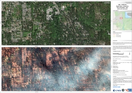
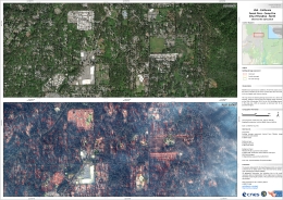
Wildfires spread across California between July and December, displacing thousands of people and leaving 104 dead. A national disaster was declared in August, but in November strong winds worsened the situation further, destroying an estimated 18,000 buildings. Three fires swept across the towns of Paradise in the north, and two other fires occurred in the Los Angeles and Ventura counties.
The fires are a result of warm temperatures in a region which has experiences no rain for a month. Wind caused the fire outbreaks to spread. More than 9,000 firefighters worked to contain the fires, which burnt over 766,000 hectares of land.
The town of Paradise particularly suffered in the disaster, and the Federal Emergency Management Agency (FEMA) have reported that it will take years to rebuild the town.
California often experiences wildfires in the summer and early autumn, but fires such as these leave some experts concerned that a changing climate may make the fires more common throughout the year.
Related News and Resources
| Tipo de evento: | Fire |
| Local do evento: | United States |
| Data da Ativação da Carta: | 2018-11-14 |
| Tempo de Ativação da Carta: | 11:22 |
| Zona de Tempo da Ativação da Carta: | UTC-06:00 |
| Requisitante da Carta: | USGS on behalf of National Guard Bureau - Joint Operational Intelligence Branch |
| ID da Ativação: | 591 |
| Gerenciamento de projeto: | University of Wyoming |
Products
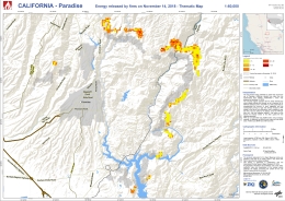
Fire energy release map, Paradise, Butte County, California, United States
Direitos autorais: TET-1: © DLR e. V. 2018
Map produced by DLR/ZKI
Information about the Product
Adquirida: 14/11/2018
Fonte: TET-1
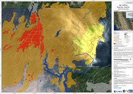
Fire situation map, Paradise, Butte County, California, United States
Direitos autorais: Pleiades: © CNES (2018) - Distribution: Airbus Defence and Space, all rights reserved
Sentinel-2: © Contains modified Copernicus Sentinel data (2018)
Map produced by SERTIT
Information about the Product
Adquirida: Pleiades: Between 16/11/2018 and 20/11/2018
Sentinel-2: 16/11/2018
Fonte: Pleiades / Sentinel-2
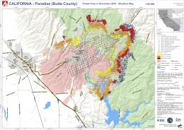
Fire situation map, Paradise, Butte County, California, United States
Direitos autorais: TET-1: © DLR e. V. 2018
Suomi NPP: © NASA/NOAA 2018
RapidEye: © Planet (2018) - All rights reserved
Map produced by DLR/ZKI
Information about the Product
Adquirida: 08/11/2018 - 20/11/2018
Fonte: TET-1 / Suomi NPP / RapidEye
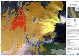
Fire situation map, Paradise, Butte County, California, United States
Direitos autorais: Pleiades © CNES (2018) - Distribution: Airbus Defence and Space, all rights reserved
Sentinel-2 © Contains modified Copernicus Sentinel data (2018)
Map produced by SERTIT
Information about the Product
Adquirida: Pleiades: Between 16/11/2018 and 18/11/2018
Sentinel-2: 16/11/2018
Fonte: Pleiades / Sentinel-2
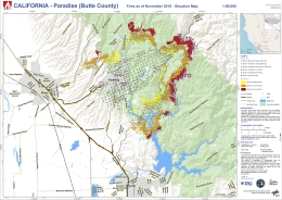
Fire situation map, Paradise, Butte County, California, United States
Direitos autorais: TET-1: © DLR e. V. 2018
Suomi-NPP: © NASA/NOAA 2018
Map produced by DLR/ZKI
Information about the Product
Adquirida: 08/11/2018 - 16/11/2018
Fonte: TET-1 / Suomi NPP
 Voltar ao arquivo completo da Ativação

 English
 Spanish
 French
 Chinese
 Russian
 Portuguese
