Minimizar Latest Activation

Charter activations

Fire in Bolivia

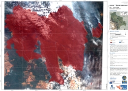
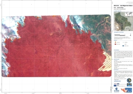
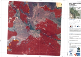
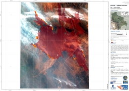
Wildfires swept across large swathes of Bolivia throughout August where more than 2,700 fires had been registered by Bolivia's early warning fire detection agency.

The areas most affected by the fires are Robore and San Ignacio de Velasco, although work to control the fire is being carried out in other locations including San Rafael, Charagua, Concepcion, San Matias, and San Jose de Chiquitos.

Media reports suggest that deforestation and burning was the primary cause of the uncontrolled fires, which were spread through dry forest areas by strong winds.

Firefighters from Chile and Argentina as well as France, Spain and Russia were deployed to help fight the flames.

Rain has fallen in some fire hotspots helping to supress the spread of the flames. Firefighters are now focusing on preventing fires reaching the Noel Kempff Mercado National Park.

Tipo de evento:fire
Local do evento:Bolivia
Data da Ativação da Carta:2019-09-02
Tempo de Ativação da Carta:12:30
Zona de Tempo da Ativação da Carta:UTC+02:00
Requisitante da Carta:Centre Opérationnel de Gestion Interministérielle des Crises (COGIC)
ID da Ativação:619
Gerenciamento de projeto:SERTIT

Products

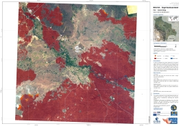
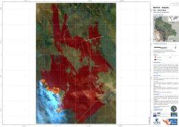
Fire extent in Ñuflo de Chávez Province, Bolivia

Direitos autorais: © Airbus DS (2019)
Map produced by SERTIT

Information about the Product

Adquirida: 05/09/2019

Fonte: SPOT-6

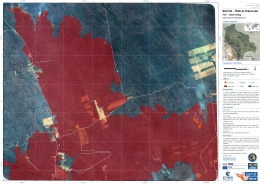
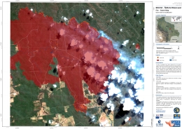
Fire extent in José Miguel de Velasco, Bolivia

Direitos autorais: © Airbus DS (2019)
Map produced by SERTIT

Information about the Product

Adquirida: 05/09/2019

Fonte: SPOT-6

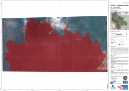
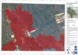
Fire extent in Ángel Sandoval Province, Bolivia

Direitos autorais: © CNES (2019) - Distribution: Airbus Defence and Space, all rights reserved
Map produced by SERTIT

Information about the Product

Adquirida: 05/09/2019

Fonte: Pleiades

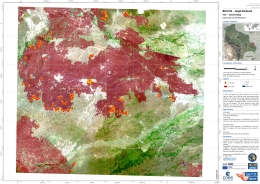
Fire extent in Chiquitos Province, Bolivia

Direitos autorais: © Airbus DS (2019)
Map produced by SERTIT

Information about the Product

Adquirida: 04/09/2019

Fonte: SPOT-7

Fire extent in Ángel Sandoval Province, Bolivia

Direitos autorais: © Airbus DS (2019)
Map produced by SERTIT

Information about the Product

Adquirida: 04/09/2019

Fonte: SPOT-7

Fire extent in Ñuflo de Chávez Province, Bolivia

Direitos autorais: © Airbus DS (2019)
Map produced by SERTIT

Information about the Product

Adquirida: 03/09/2019

Fonte: SPOT-6

Fire extent in José Miguel de Velasco, Bolivia

Direitos autorais: © Airbus DS (2019)
Map produced by SERTIT

Information about the Product

Adquirida: 03/09/2019

Fonte: SPOT-6

Fire extent in Ángel Sandoval Province, Bolivia

Direitos autorais: © Contains modified Copernicus Sentinel data (2019)
Map produced by SERTIT

Information about the Product

Adquirida: 02/09/2019

Fonte: Sentinel-2

Fire extent in Chiquitos Province, Bolivia

Direitos autorais: © Contains modified Copernicus Sentinel data (2019)
Map produced by SERTIT

Information about the Product

Adquirida: 02/09/2019

Fonte: Sentinel-2

Fire extent in Ñuflo de Chávez Province, Bolivia

Direitos autorais: © Contains modified Copernicus Sentinel data (2019)
Map produced by SERTIT

Information about the Product

Adquirida: 31/08/2019

Fonte: Sentinel-2

Fire extent in Ñuflo de Chávez Province, Bolivia

Direitos autorais: © Contains modified Copernicus Sentinel data (2019)
Map produced by SERTIT

Information about the Product

Adquirida: 31/08/2019

Fonte: Sentinel-2

Voltar ao arquivo completo da Ativação