Charter activations
Flooding in Bangladesh
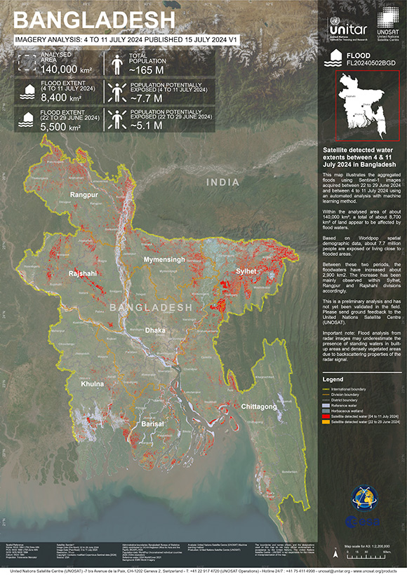
Extensive flooding has affected over two million people in north-eastern Bangladesh, following weeks of heavy monsoon rainfall that have submerged homes and devastated farmland.
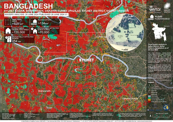
Much of the Sylhet district (75 percent), including over half the area's crops and paddy fields, are submerged, threatening livelihoods and food security.
According to reports from the water development board, widespread flooding was triggered by prolonged torrential rain and water runoff from the hilly regions upstream on the border with India, which caused four rivers to swell beyond their danger marks.
Water and sanitation infrastructure across the region has suffered major damage. Hundreds of schools were flooded. Dozens of child protection community hubs — UNICEF-supported facilities hosting a range of activities for children — were also flooded and partially damaged.
Bangladesh is used to flooding, but climate change is making floods more intense and less predictable, making it impossible for families to stay safe, let alone plan ahead," said Khondoker Golam Tawhid, Programme Head, Disaster Risk Management Programme, BRAC.
The worst-affected areas are receiving emergency health, nutrition, safe water and sanitation, from BRAC, funded by UNICEF.
Related Resources:
| Type of Event: | Flood |
| Location of Event: | Bangladesh |
| Date of Charter Activation: | 2024-06-25 |
| Time of Charter Activation: | 16:58 |
| Time zone of Charter Activation: | UTC+02:00 |
| Charter Requestor: | UNOSAT on behalf of WFP |
| Activation ID: | 888 |
| Project Management: | Jakrapong Tawala (UNITAR) |
| act-value-adders: | Camila Gonçalves dos Santos (UFRRJ) |
Products

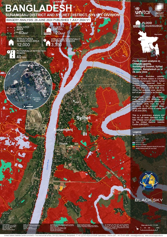
Flood impact analysis in Chhatak Upazila, Sunamganj District, Sylhet Division, Bangladesh
Copyright: BlackSky Technology Inc. (on behalf of itself and its Affiliates, collectively "BlackSky") provides notification that its imagery and logos are trademarked and under copyrights of BlackSky. The further use and/or dissemination of this imagery and/or any product in any way derived there from are restricted without express prior written permission.
Map produced by UNITAR / UNOSAT
Information about the Product
Acquired: 26/06/2024
Source: GLOBAL
Category: Grading Map

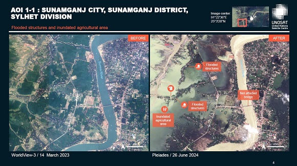
Preliminary Satellite-derived Flood Impact Assessment, Sylhet Division, Bangladesh
Download the full report
Copyright: Includes Pleiades material © CNES (2024), Distribution Airbus DS.
Report prepared by UNITAR / UNOSAT
Information about the Product
Acquired: 26/06/2024
Source: Pleiades
Category: Dossier
 Back to the full activation archive

 English
 Spanish
 French
 Chinese
 Russian
 Portuguese


