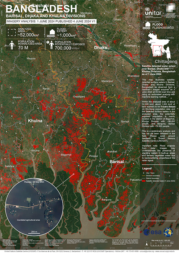
Charter activations
Cyclone Remal in Bangladesh
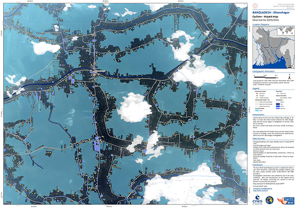
Cyclone Remal formed over the northern Bay of Bengal on May 25, it crossed the Indian border between West Bengal state and the Khulna region of Bangladesh on May 26 around 18:00 UTC.
The storm brought tidal surges as high as 12 feet to many southwestern coastal areas of Bangladesh, along with heavy rainfall and wind speeds reaching up to 120 km/h. Tragically, 16 deaths were reported: some individuals drowned, while others were crushed by collapsing buildings.
The cyclone affected a total of 3.75 million people, with 35,483 homes destroyed and another 115,992 homes damaged. Nearly a million people were evacuated to safety
Related Resources:
| Type of Event: | Flood |
| Location of Event: | Bangladesh |
| Date of Charter Activation: | 2024-05-28 |
| Time of Charter Activation: | 18:25 |
| Time zone of Charter Activation: | UTC+07:00 |
| Charter Requestor: | UNOSAT on behalf of United Nations Economic and Social Commission for Asia and the Pacific (UNESCAP) |
| Activation ID: | 884 |
| Project Management: | Jakrapong Tawala (UNITAR) |
| act-value-adders: | Md Mahmudur Rahman (Bangladesh Space Research and Remote Sensing Organization (SPARRSO)) Murad Billah (UNOSAT) SERTIT Rapid Mapping Service (SERTIT Rapid Mapping Service) |
Products
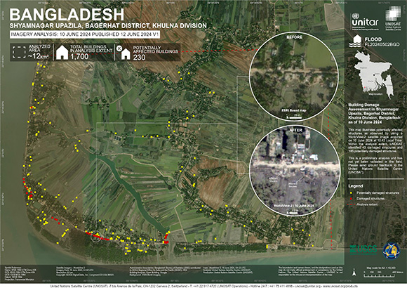
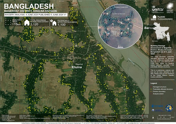
Building Damage Assessment in Shyamnagar Upazila, Bagerhat District, Khulna Division, Bangladesh
Copyright: © (2024) DigitalGlobe, Inc., Longmont CO USA 80503. DigitalGlobe and the DigitalGlobe logos are trademarks of DigitalGlobe, Inc. The use and/or dissemination of this data and/or of any product in any way derived there from are restricted. Unauthorized use and/or dissemination is prohibited
Map produced by UNITAR / UNOSAT
Information about the Product
Acquired: 10/06/2024
Source: WorldView-2
Category: Grading Map
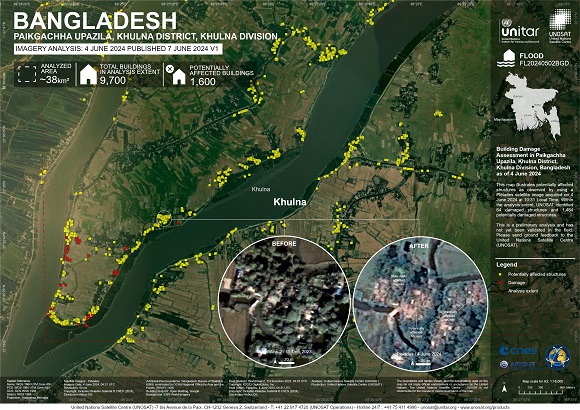
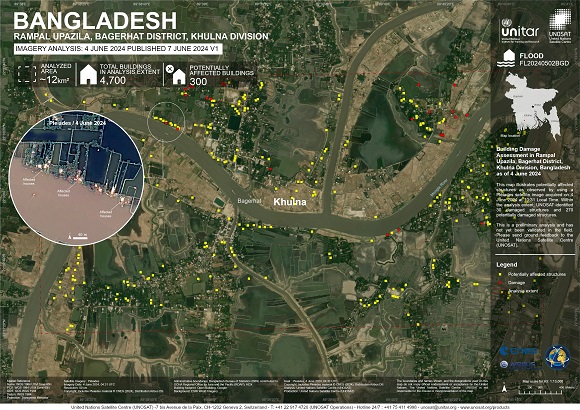
Building Damage Assessment in Paikgachha Upazila, Khulna District, Khulna Division, Bangladesh
Copyright: WorldView-2 © (2023) DigitalGlobe, Inc., Longmont CO USA 80503. DigitalGlobe and the DigitalGlobe logos are trademarks of DigitalGlobe, Inc. The use and/or dissemination of this data and/or of any product in any way derived there from are restricted. Unauthorized use and/or dissemination is prohibited.
Includes Pleiades material © CNES (2024), Distribution Airbus DS.
Map produced by UNITAR / UNOSAT
Information about the Product
Acquired: WorldView-2: 15/12/2023
Pleiades: 04/06/2024, 06/06/2024
Source: WorldView-2, Pleiades
Category: Grading Map
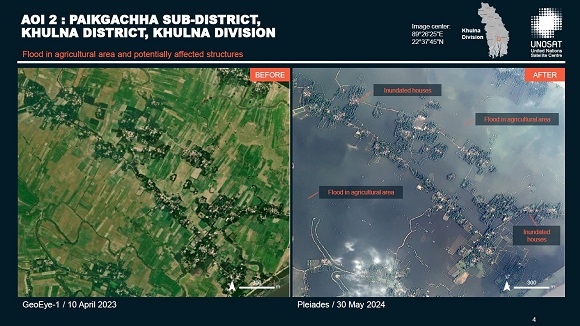
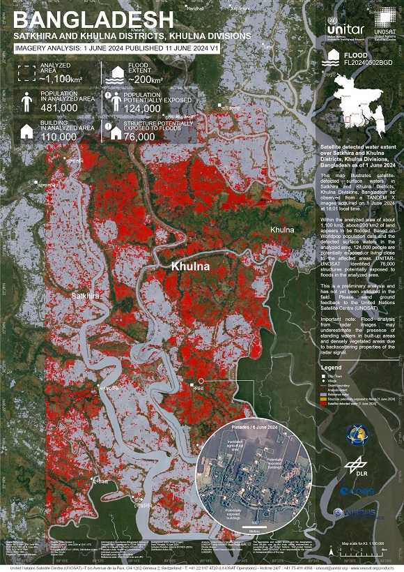
Preliminary satellite-derived flood impact assessment, Khulna Division, Bangladesh
Download the full report
Copyright: Includes Pleiades material © CNES (2024), Distribution Airbus DS.
WorldView-3 © (2023) DigitalGlobe, Inc., Longmont CO USA 80503. DigitalGlobe and the DigitalGlobe logos are trademarks of DigitalGlobe, Inc. The use and/or dissemination of this data and/or of any product in any way derived there from are restricted. Unauthorized use and/or dissemination is prohibited.
GeoEye-1 © 2004 GeoEye NextView License
Report produced by UNITAR / UNOSAT
Information about the Product
Acquired: Pleiades: 30/05/2024
GeoEye-1: 10/04/2023
WorldView-3: 09/04/2023
Source: Pleiades / WorldView-3 / GeoEye-1
Category: Dossier
 Back to the full activation archive

 English
 Spanish
 French
 Chinese
 Russian
 Portuguese
